The Lion Rock (獅子山): HK urban hike
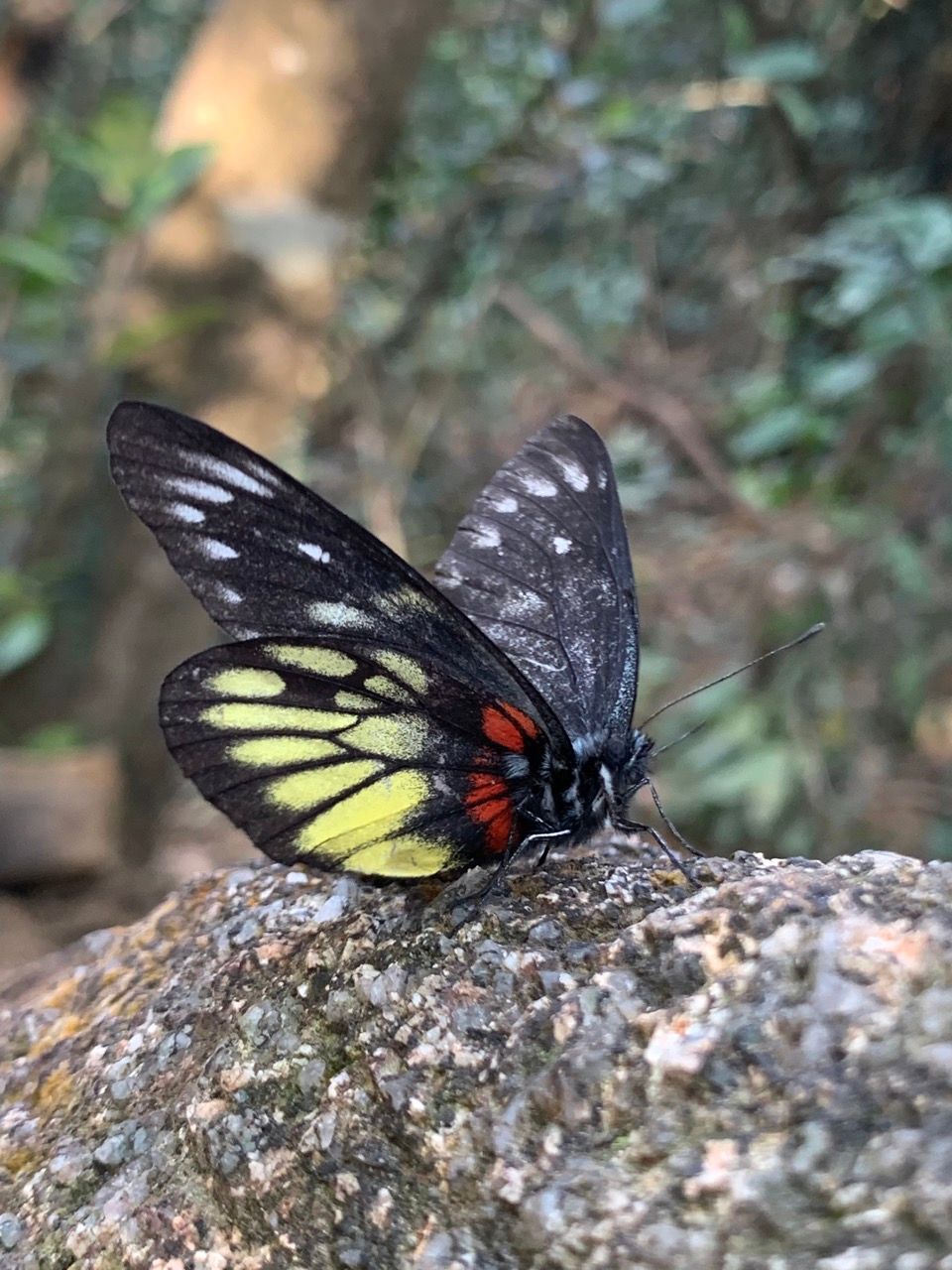
In Hong Kong, in half an hour one can go from a cosmopolitan metropolis surrounded by international shopping malls to a mountain, listening to the sound of bamboo blowing in the breeze, a rich green vista of mountains, lakes, beaches and ocean, with wild monkeys, pigs, birdsong and butterflies.

What's the Lion Rock?
Hong Kong enjoys a fabulous juxtaposition of countryside and city like no other place in the world. Although the city has undergone a large number of political changes in recent years that have affected the makeup of society, the outlook, its position as part of China and freedom of speech, its amazingly beautiful countryside, islands and vistas can't be easily taken away and will continue to amaze visitors for years to come. In Hong Kong, one can be in a teaming, noisy, cosmopolitan metropolis surrounded by shopping malls and restaurants full of international brands at 3pm, and by 3:30pm be on a mountain, listening to the clacking sound of bamboo plants blowing in the breeze, taking in a rich green vista of mountains, lakes, beaches and ocean, with wild monkeys, pigs, chirping birds and kaleidoscopes of butterflies in the vicinity.
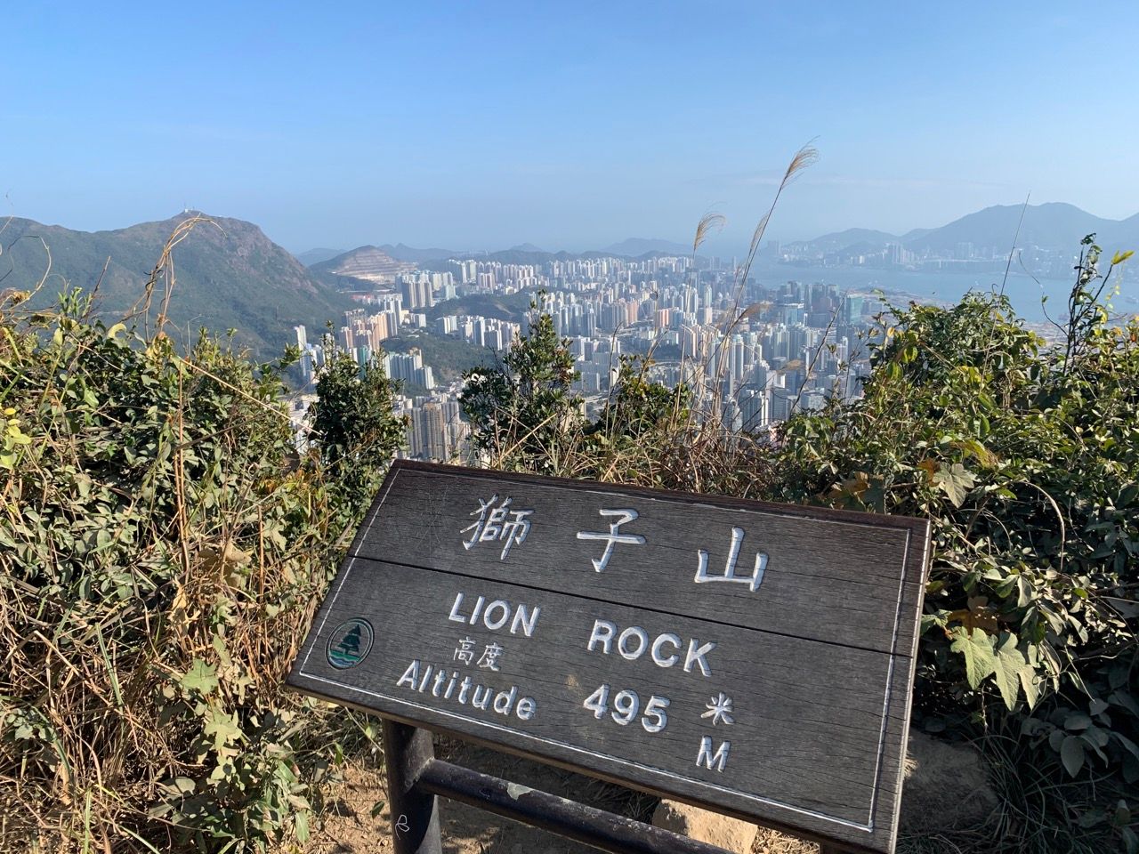
The Lion Rock is my favourite such hike. It's not too strenuous, can be accomplished in a couple of hours and has amazing vistas. The Lion Rock itself is a famous landmark in Hong Kong. It's a rock atop a peak on the Kowloon peninsula which, viewed from certain angles, has various properties of the shape of a lion such as a head, a mane, and a back. Some people view the Lion as "watching over" the city and the people from on high, and for several decades the "Lion Rock Spirit" (獅子山精神; shizi shan jingshen) described the collective hard-working, can-do, proud attitude that drove the amazing economic growth and development of the territory.
Getting to the mountain
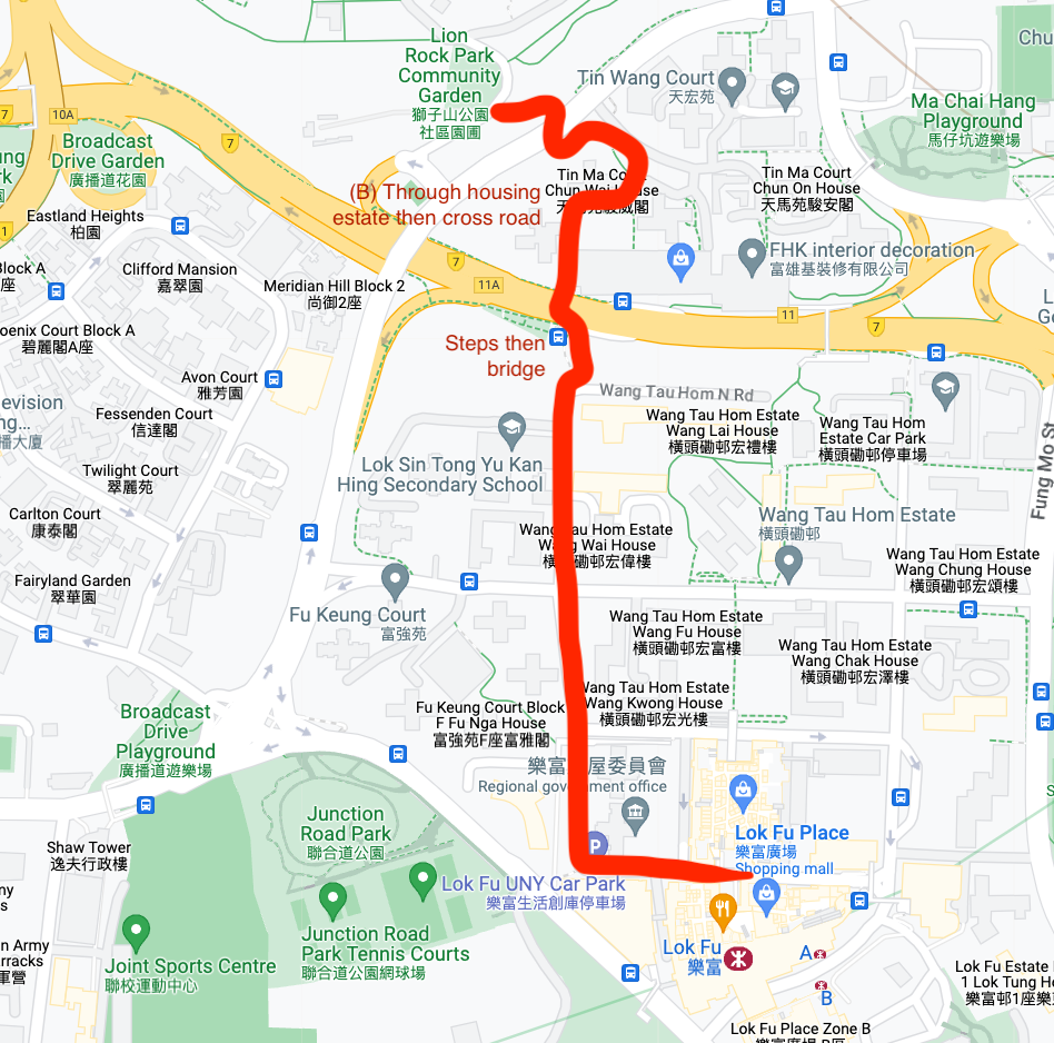
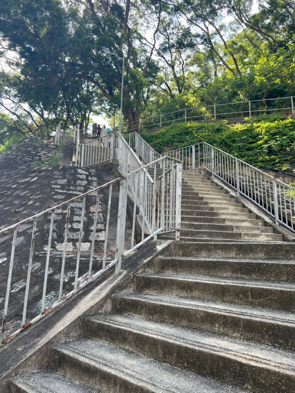
With all that waffle out the way, here's the route I normally take. Start by taking the MTR (subway) to Lok Fu station, and follow the route I've overlayed on Google Maps here. You're walking from the station to LionRock Park Community Garden, but google itself does a horrible job of finding the best route! This is only about a 10 minute walk; I've annotated in red below where you walk up some steps and cross the busy Lung Cheung Road via a bridge, and then walk through the Tin Ma Court housing development on the other side then walk carefully across the smaller Chuk Yuen Road.
If walking in the summer heat, take plenty of water, try to cover your head and face and refresh the sunblock often. Although the top of the mountain is somewhat cooler due to its relatively high altitude (roughly 500m or 1600ft), the climb upwards can result in literally sweating and dripping buckets in the summer sun! There are plenty of convenience stores in Lok Fu where such supplies can be easily procured.
After crossing the road you'll be met with a sign and some concrete steps leading upwards. The mountain in front looks a bit intimidating but it's not too tough after all. Take the concrete steps to the left to walk up to the base of the mountain.
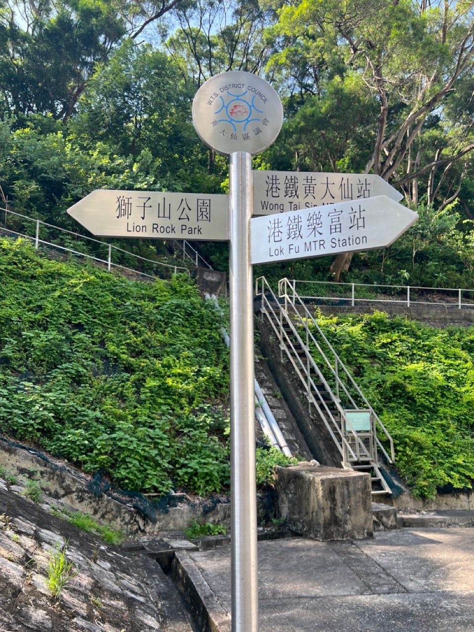
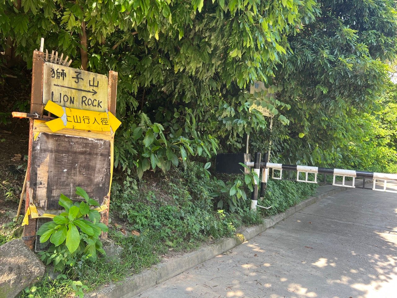
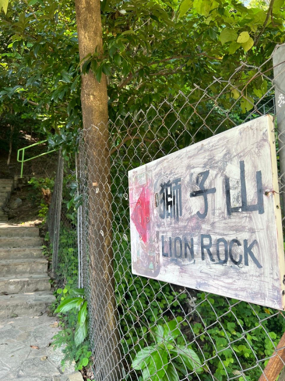
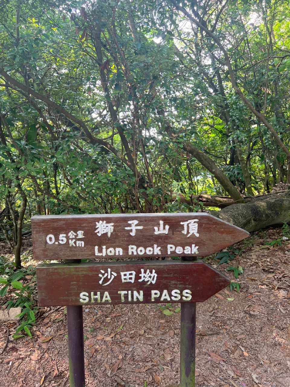
Turn right at the bright yellow sign below, and continue to walk upwards until you see the white sign pointing left on a fence. This sign denotes the base of the trail going up the mountain, at which point the real climb starts.
Ascending the mountain
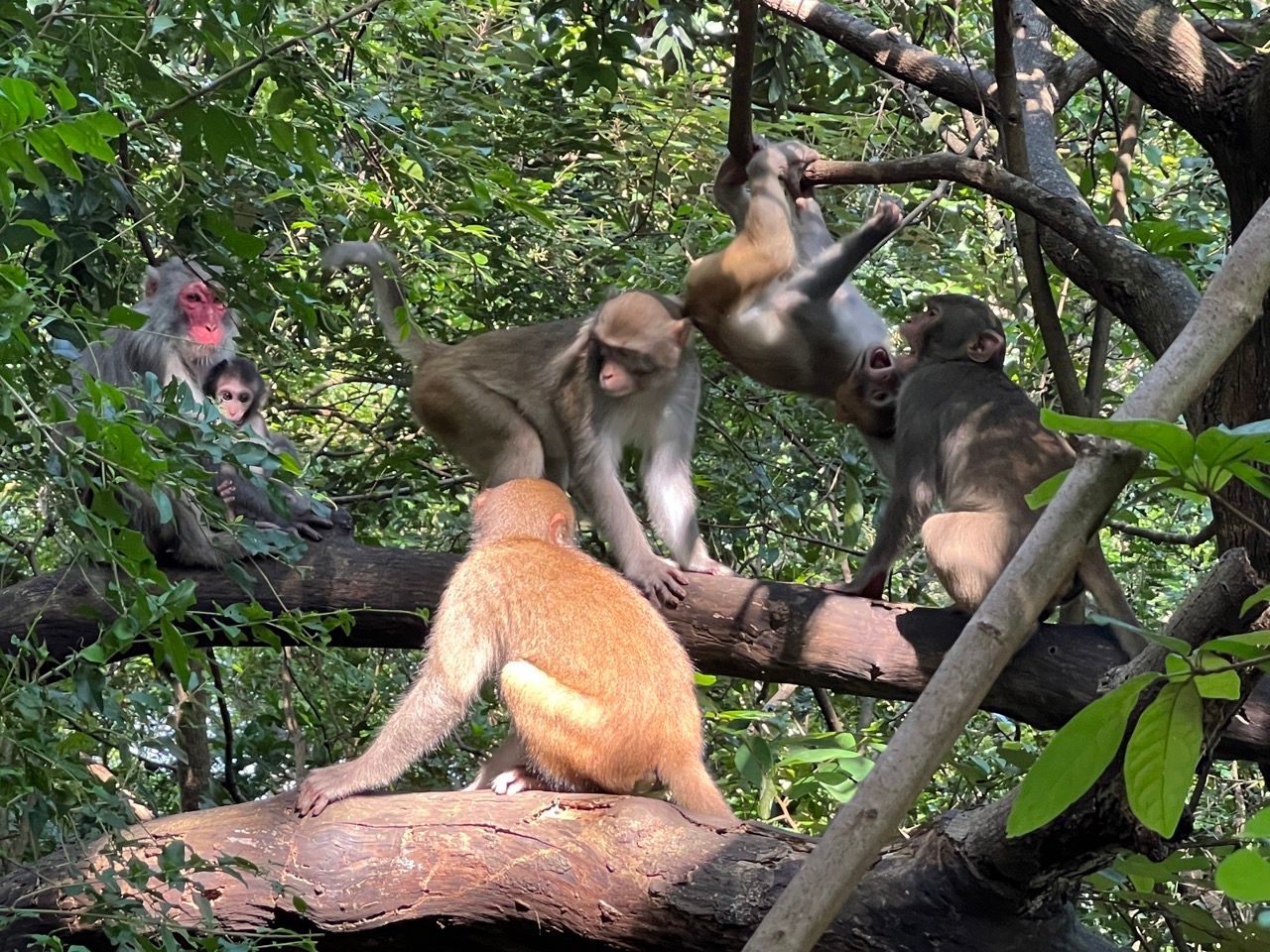
No directions are really needed - just keep following the trail. It's not uncommon to find a large number of monkeys hanging out in the bottom sections of the trail. They generally keep their distance from humans, but keep belongings close (some of them like to steal things) and don't approach or threaten them.
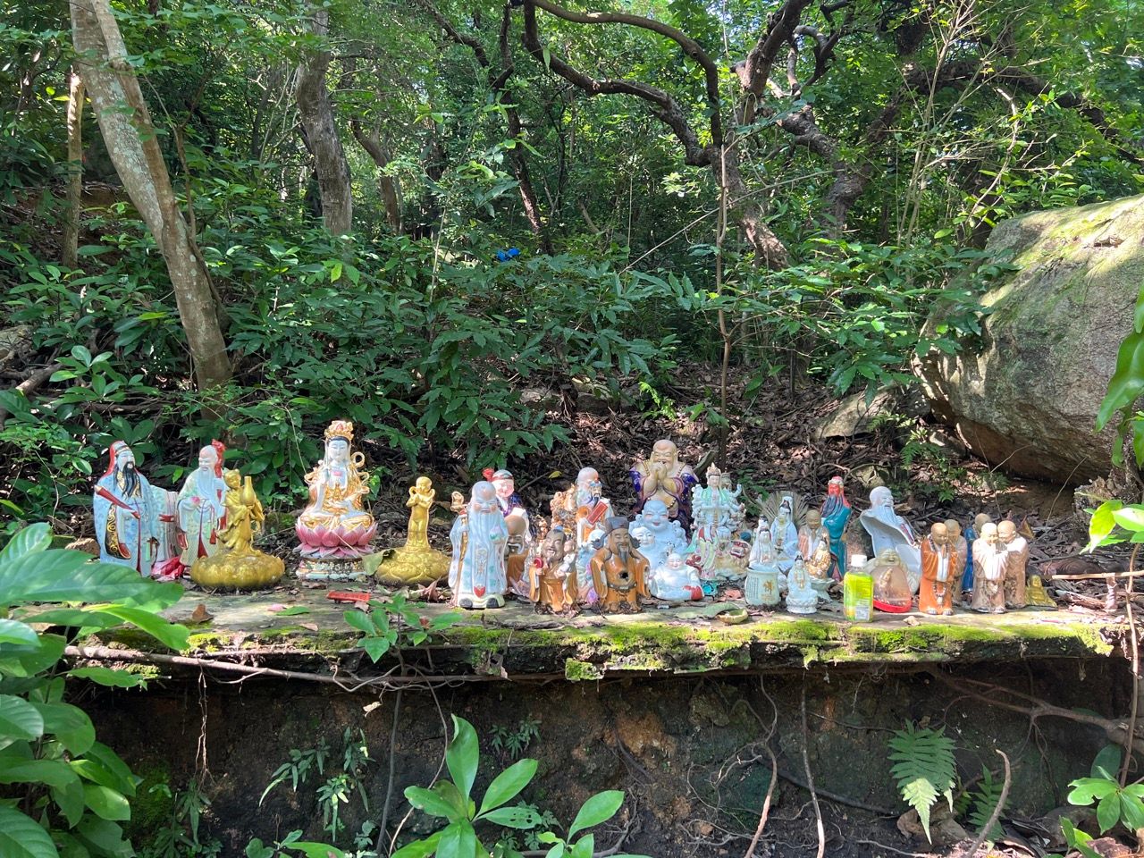
However in the early stages of the trail, there's a detour that one can take to bypass some of the newer concrete path and switch to taking a slightly overgrown abandoned older trail. The latter is a more interesting route and it's not really possuble to get lost since the trail rejoins the newer one slightly further ahead. The older trail requires jumping over some tree branches but also goes through an area with some convenient sitting stones and a collection of buddhist figurines and is normally rather peaceful on crowded weekends since few people take the route.
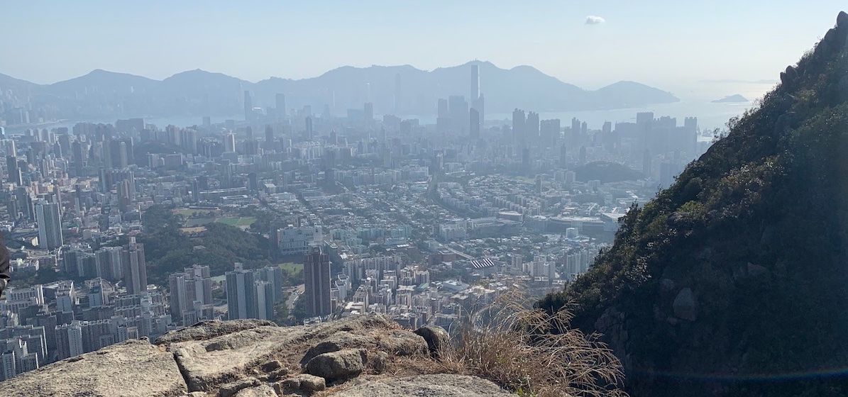
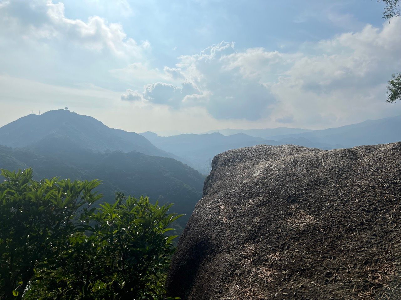
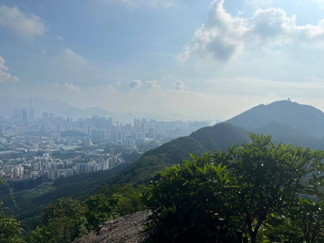
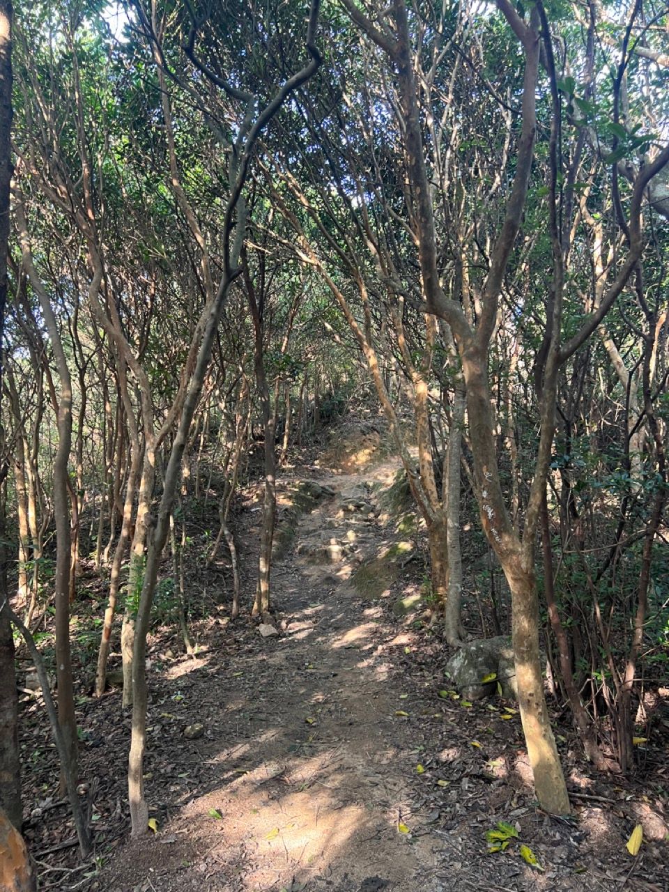
When the trail rejoins, keep on climbing and climbing. Some lower level views over the Kowloon peninsula over to Hong Kong island down below will start to emerge which can be seen by popping into some rest areas on the left hand side of the trail.
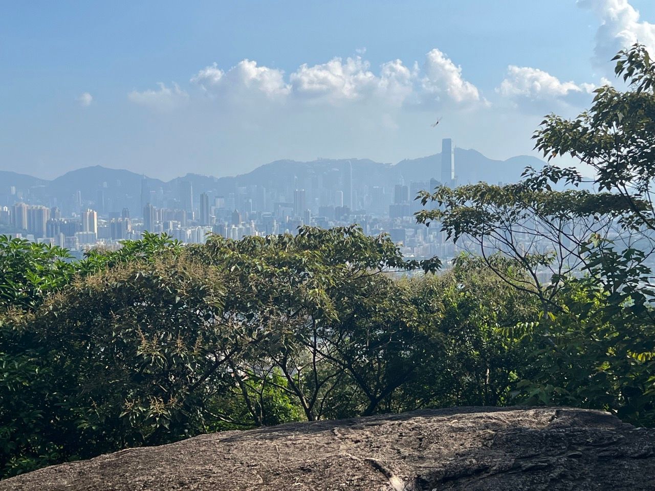
As the path winds up the mountain, the views get more and more spectacular, with increasing altitude revealing more of the buildings below. As impressive as it seems, though, these views are nothing compared to what's still to come from the top of the lion!
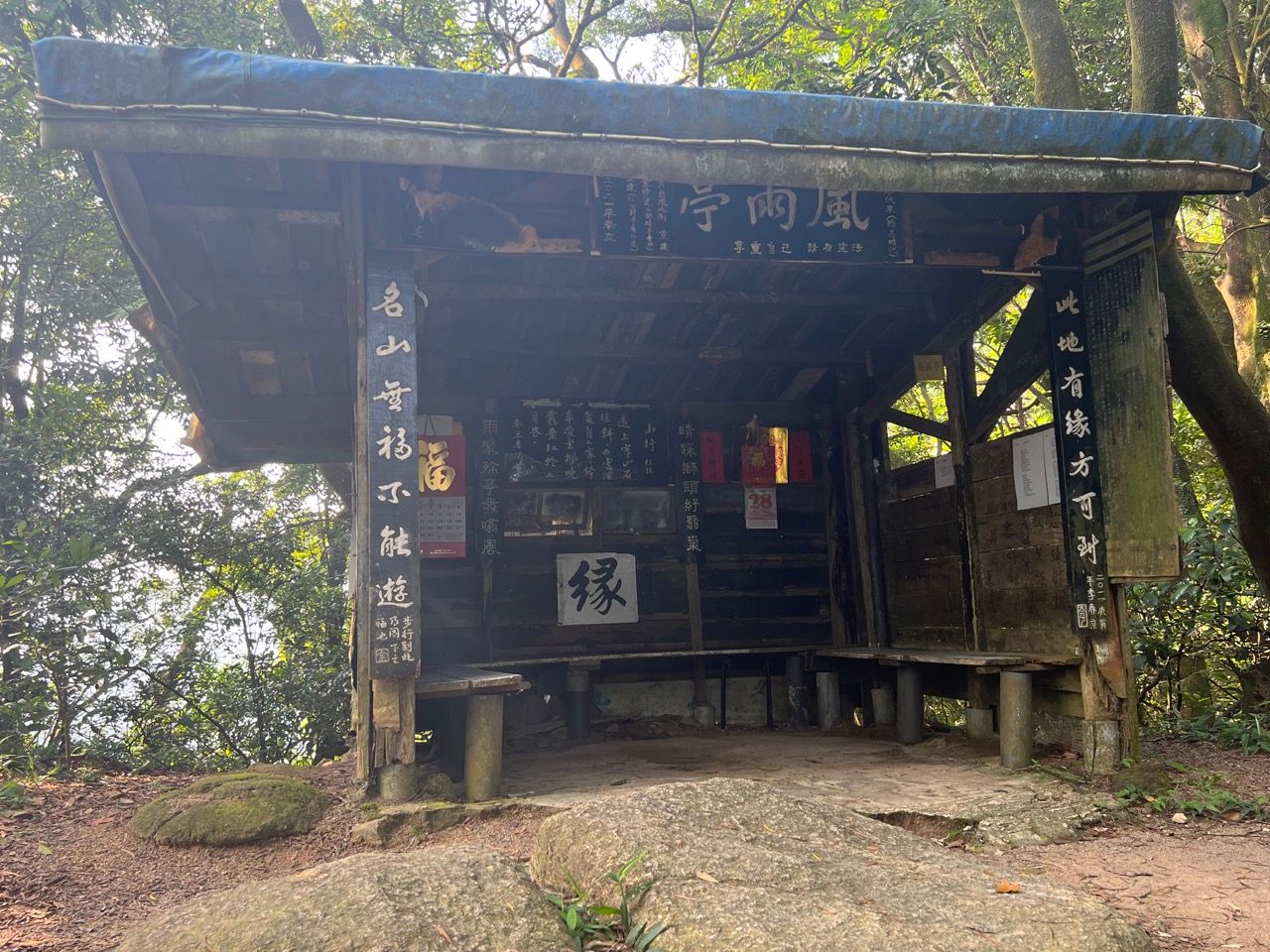
After the pavilion, follow the sign pointing to the lion rock peak and walk past what looks like an old bus stop or something from My Neighbour Totoro:
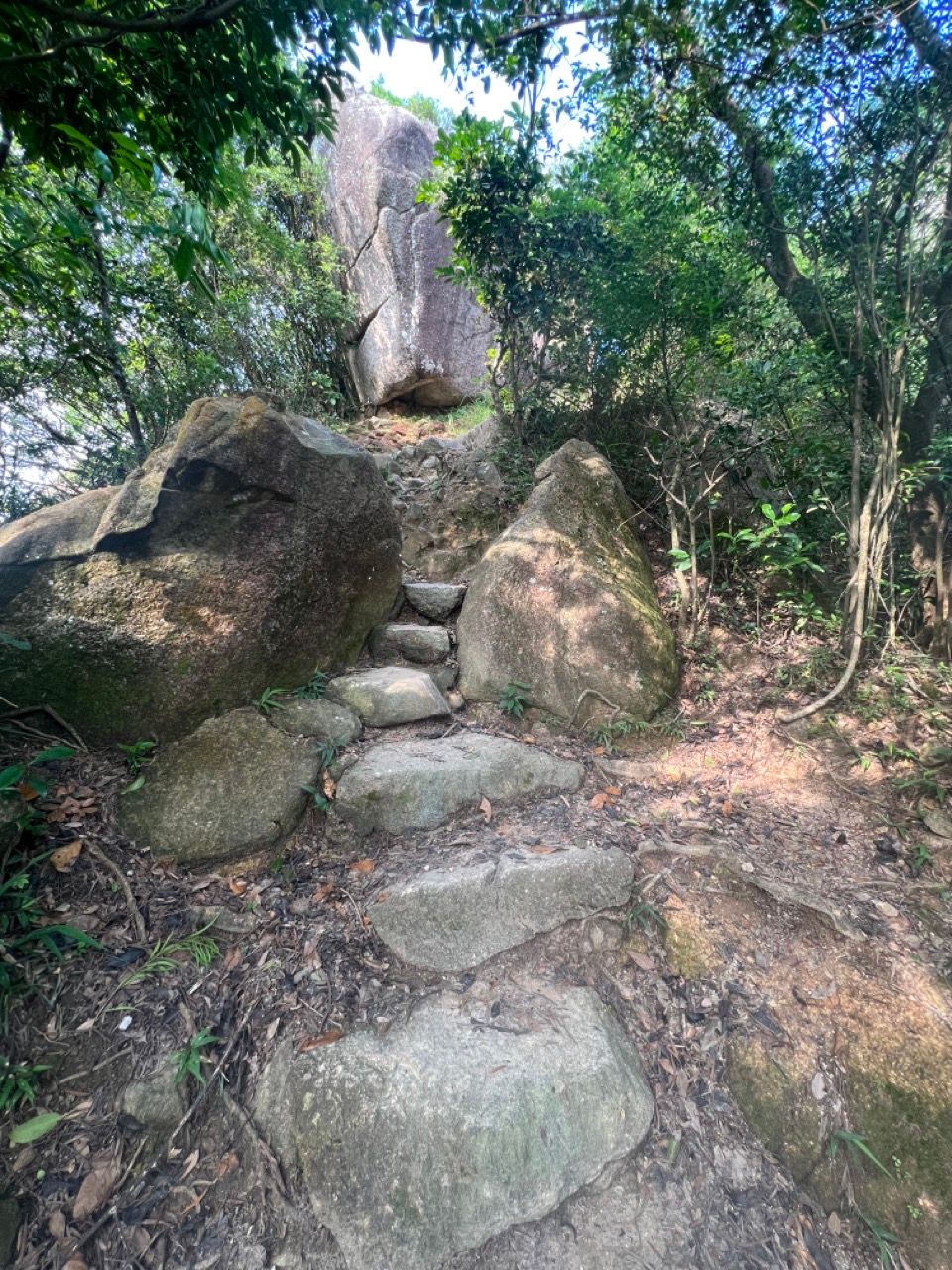
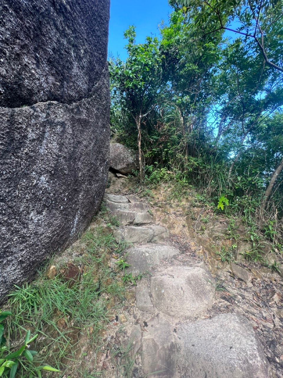
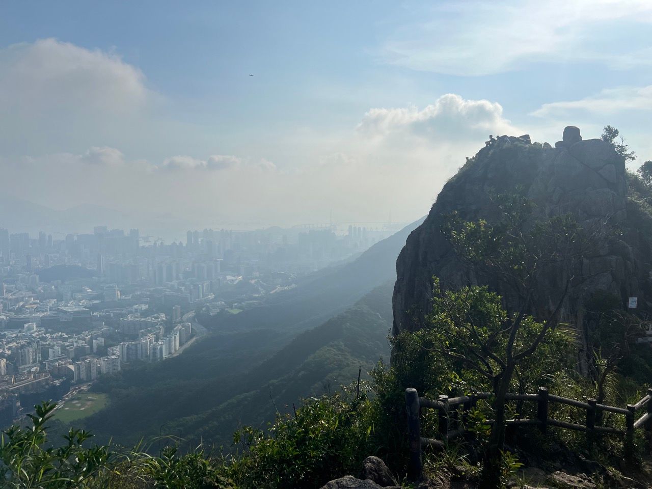
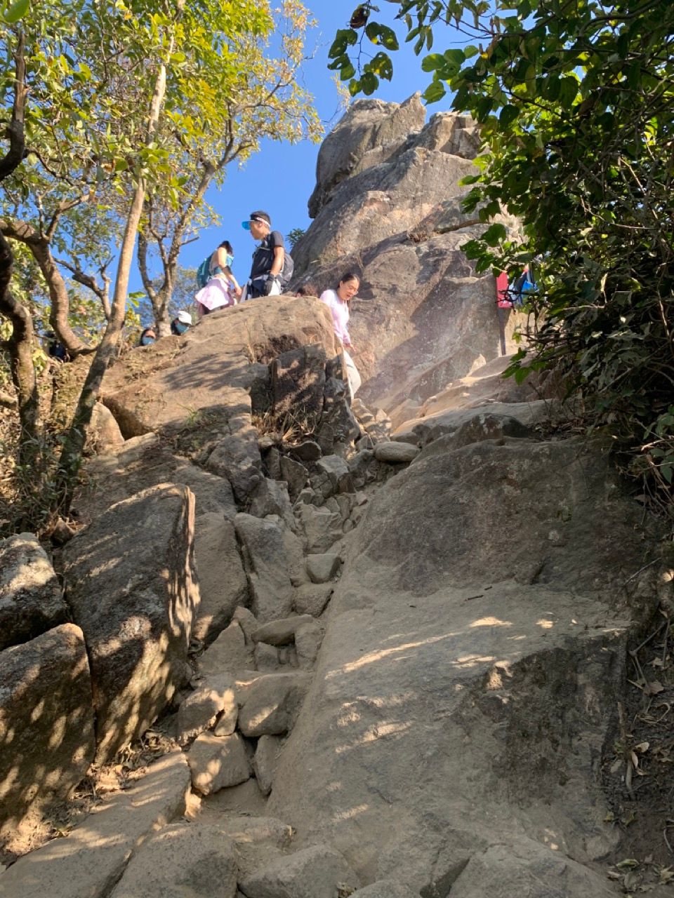
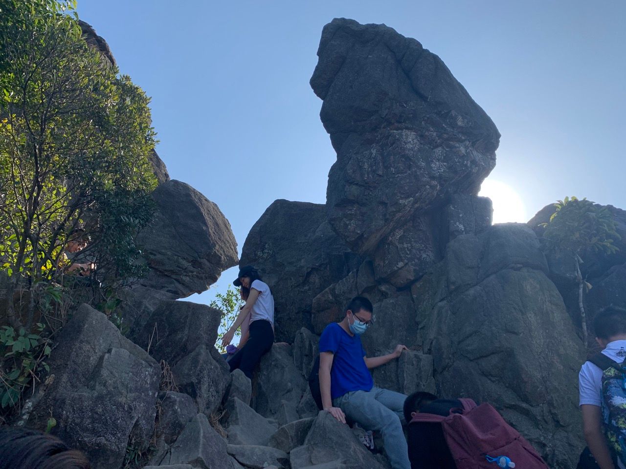
The climb up the peak is the steapest bit; wear good shoes and be careful in damp weather. As you get closer to the peak, you'll see increasingly large granite boulders lining the sides of the trail. The final part of the climb feels like a little bit of a scramble but for those with good balance it's still fairly straightforward.
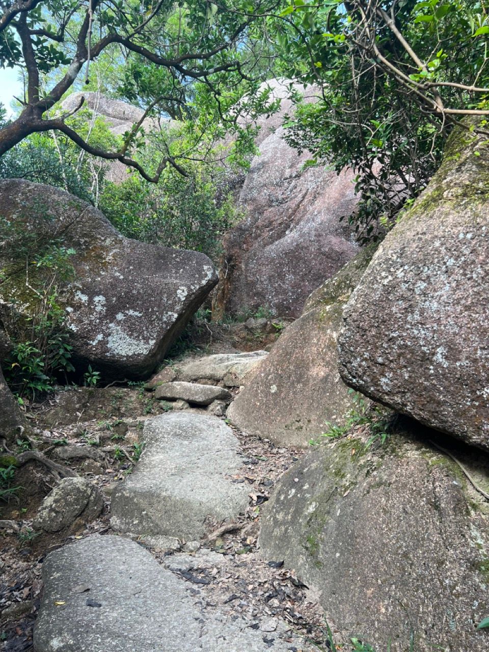
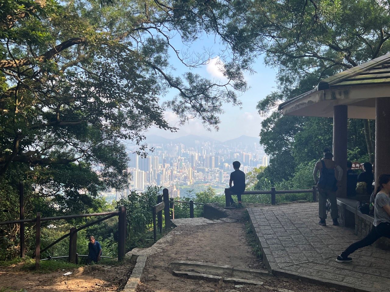
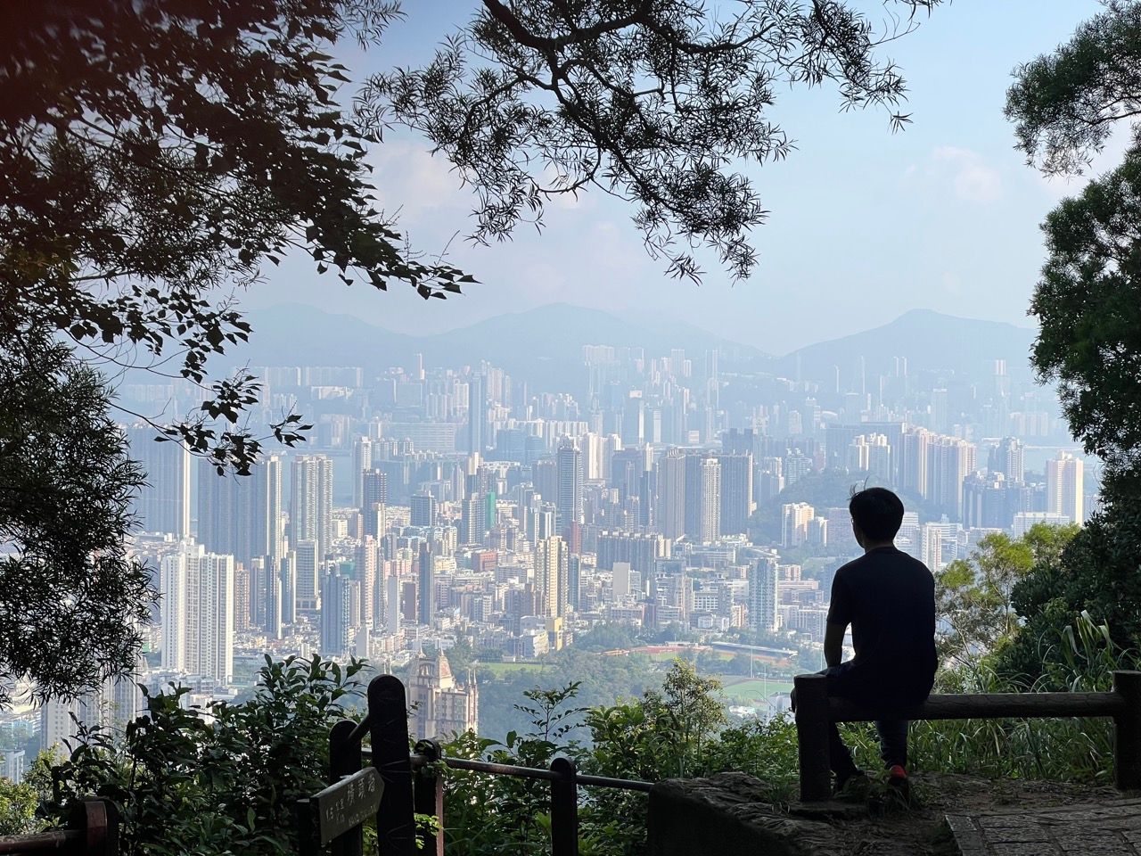
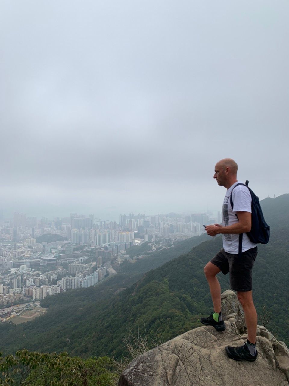
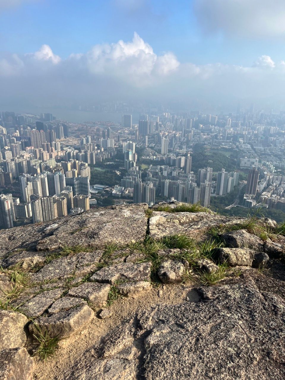
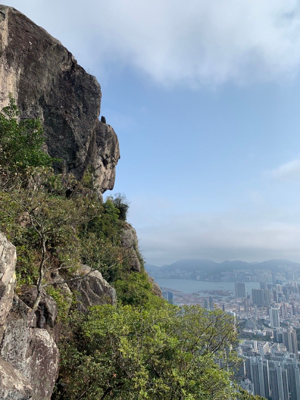
After twisting and turning a little bit on the granite path, you'll arrive at the head of the lion and the breathtaking views that it offers!
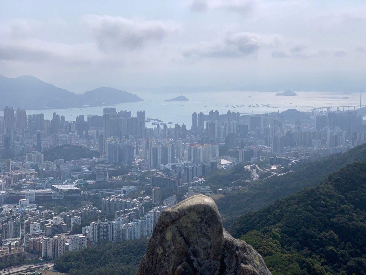
The views from the peak
The photos here simply can't do the view justice. It's absolutely stunning.
Follow the path down the back of the lion, and more fabulous views to the east, north and western New Territories will present themselves.
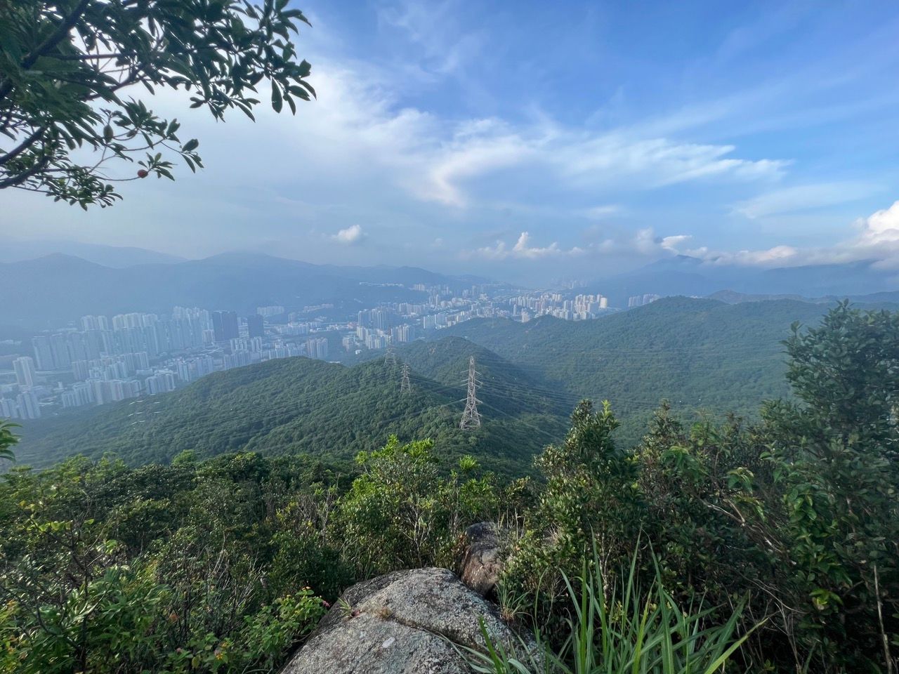
There are some side paths leading up the ribs of the lion back towards its spine (so to speak) where you can stick your head and body through more gaps in the granite to see what lies on the other side.
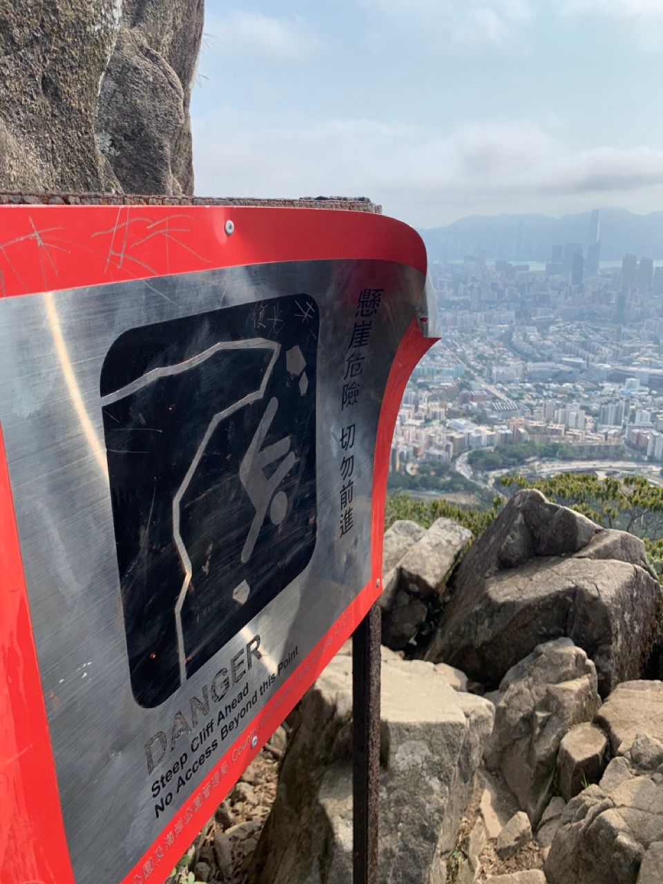
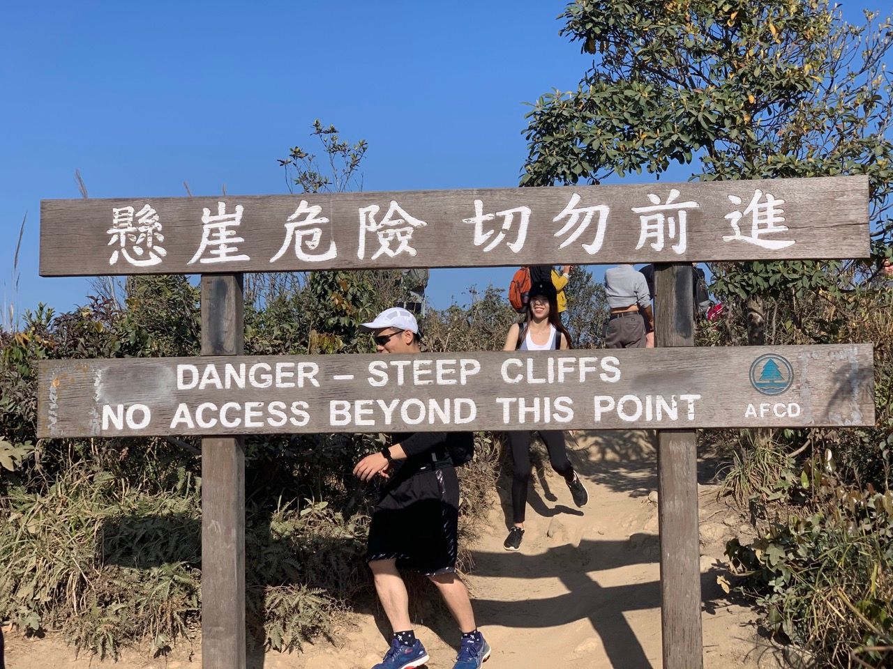
There are also some warning signs instructing one to not go beyond (of course, me being me, will always go beyond – just a little bit – to make sure the sign really does deserve being there!):
The descent
Walking down the tail of the lion you'll see a lot of folks drone flying and the occasional bit of filming taking place. Google Maps does a great job getting you off the back of the mountain and down the hill, if you choose to go that way, alternatively you can flip the bitch (U-Turn) and head back the way you came.
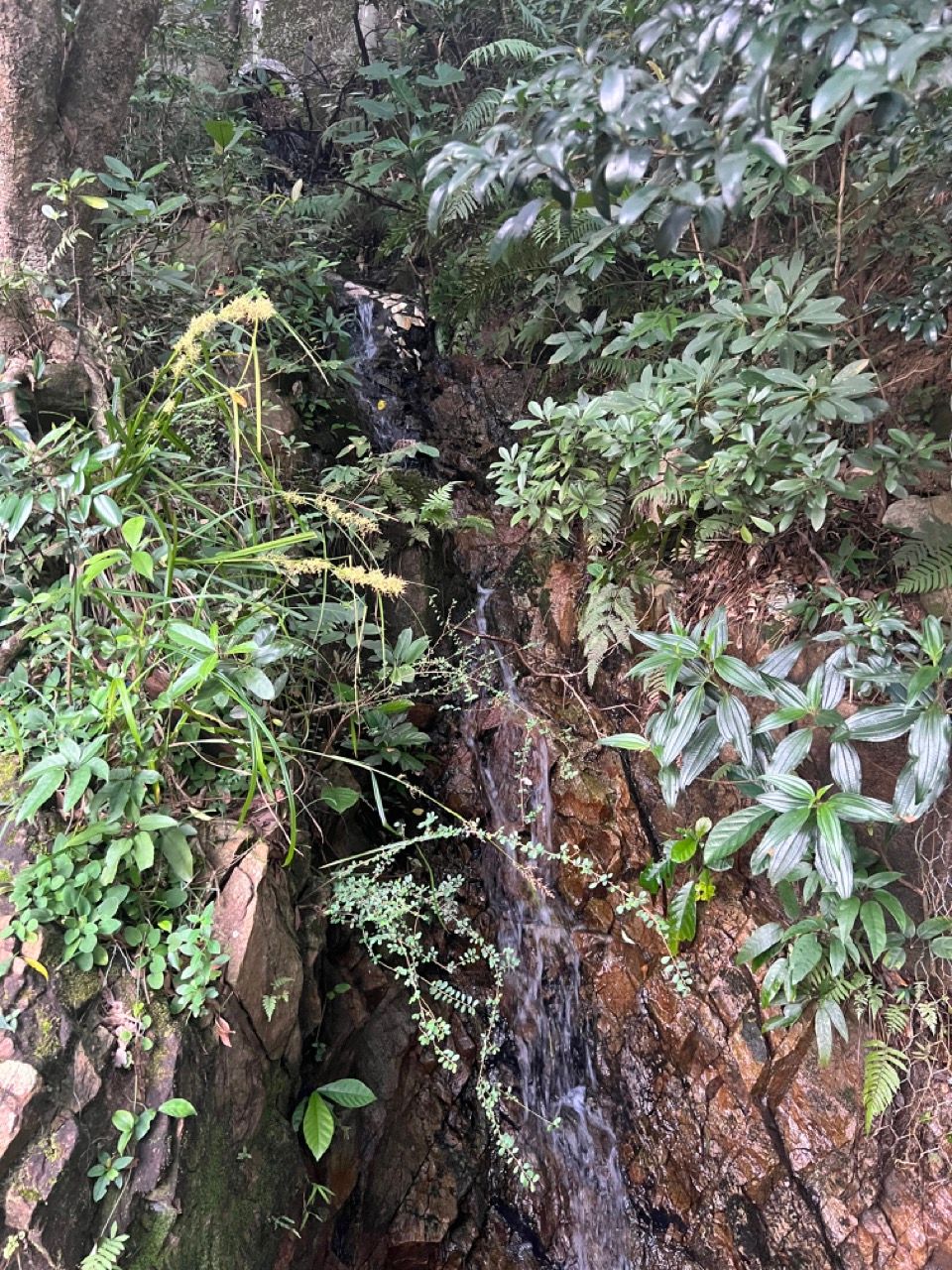
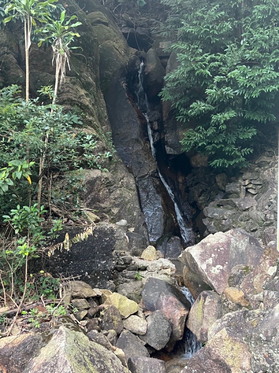
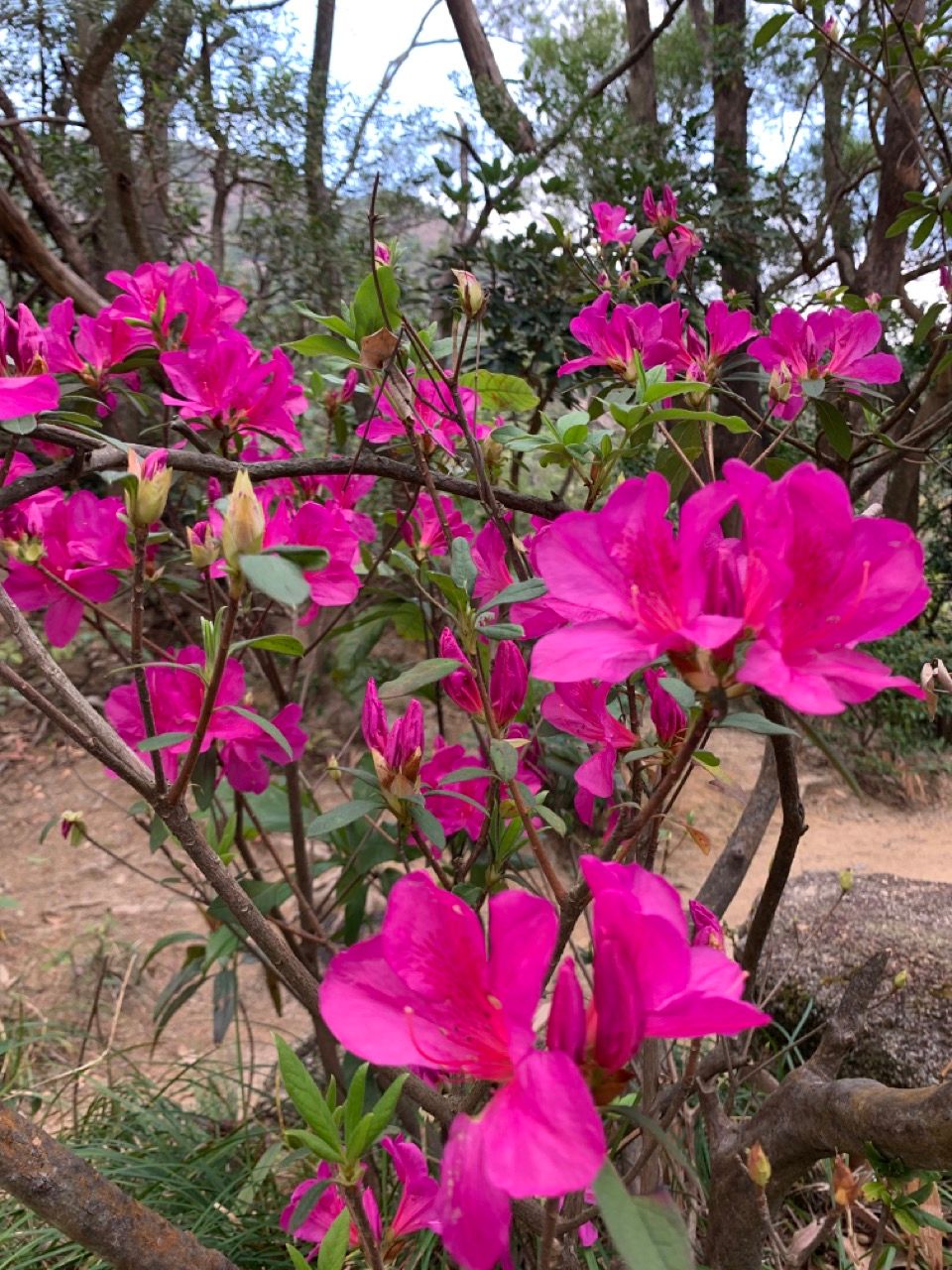
Assuming a different route, at the back of the lion's tail, bear left to start heading down the mountain, then bear right on the Maclehose Trail Section 5 heading East. Go past Distance Post 104 (Google Maps can help you with that), then Distance Post M103, and keep walking, generally heading downwards. There's often some nice wildlife, wild azaleas and some natural waterfalls to look at on the way down:
You'll start to see some tall buildings in the distance and hear the rumble of traffic. You're heading towards Lions Pavilion, then down the Shatin Pass Road, past Temple Hill Fat Jong Temple. You'll pop out close to Wong Tai Sin MTR, where you can hop back on a train, or if you're feeling more adventurous, keep walking south into Kowloon City, the Thai district, to get a good curry and a beer.
Some final thoughts
Firstly, when the weather is crap or it's really cloudy, this hike isn't really worth doing. This is something for fair weather and clear skies. Friends tell me that the sunset is the best time to be on top of the rock, since one can see the sun go down over the whole territory, but that feels a bit like a romantic engagement I've yet to partake in.
Most tourist guides will rave about the "Dragon's Back" hike on Hong Kong Island, which is viewed as one of the best urban hikes in the world and has closer views of the sea and beaches. It is indeed a wonderful hike, but in my mind the vistas of the Lion Rock, and its comparative ease of accessibility from the MTR (no bus journeys or windy roads required) are even more awesome. If you're into seeing the sea and beaches, though, rather than the urban landscape, the Dragons Back is the one to do!